STUNNING SWISS SCENERY: AUGSTMATTHORN
This is a MUST if you’re in the country and one of the top hikes we’ve ever embarked on.
The incredible trail will take you high above Brienze Lake and the city of Interlaken to the peak of Augstmatthorn.
You’ll be rewarded with a striking view of one of the most beautiful locations in Switzerland. Ready for the adventure of a lifetime?
What to Bring
Water - high elevation, so hydrate plenty, including before and after
Boots - the start of the trail can be pretty muddy
Trekking Poles - helpful for stability on the steeper and narrower areas
Download a map - reception is scarce and you’ll want it to make sure you keep to the path
Directions
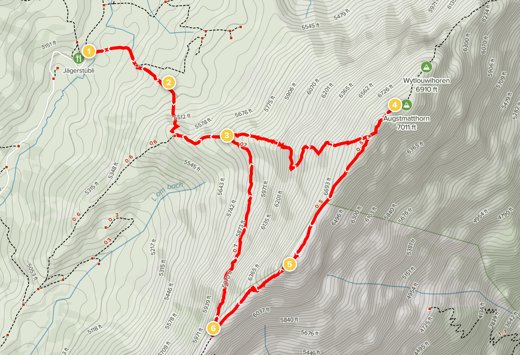
Start parking at the Jägerstübli, Lombachalp - 20 minutes north of Interlaken
Head southeast along the path, making your way through various cattle gates
After 1 mile, the path will split; head north (left) up the steep dirt path
Reach Augstmatthorn, enjoy the view, then start back down, peeling southwest (left) along the ridge when it forks back the way you came
Enjoy another viewpoint, Suggiture, before descending the steep outcropping
Walk along the mountainside path, and head back down the first trail when it rejoins
SPECS
Distance: 3.9 miles (6.3 km)
Elevation Gain: 1,740 ft (530 m)
Type: Loop
Difficulty: Moderate
Head southeast along the marked path, up towards a wooden cabin nestled on the hill. The climbing starts right away.
The ascent starts simple enough before turning into an all-out uphill assault, covering 2,000 feet gain in the first 2 miles.
Don’t forget to look and admire the view below: rolling hills behind you trail off to a beautiful mountain-lined horizon.
The entire walk is majestic, and you’ll want to take moments from your focus on the ascent to admire your incredible surroundings (and catch your breath).
Once you reach the top of Augstmatthorn, the other side's view will reveal itself: this is what you’re here for! You’re now at eye level with the vast mountain ranges towering over the Interlaken Basin.
You’re now 3,000 feet above the lake and city; everything below is peaceful and serene.
Pause here to soak in the scene, then head Southwest along the ridge that follows high above the shoreline.
Use care: your path will lead along narrow mountain spines with sheer drops inches from your feet off either side at parts.
Pause here to soak in the scene, then head Southwest along the ridge that follows high above the shoreline.
Use care: your path will lead along narrow mountain spines with sheer drops inches from your feet off either side at parts.
Climb along and stop at another viewpoint to the west, called Suggiture. This sits atop a steep rocky climb ascended by a narrow path.
As you descend from Suggiture down stone and wood steps, keep an eye out for mountain goats along the cliff walls.
They are magnificent to watch, and their cliff-side climbing stunts will amaze and delight you if you're lucky enough to catch them!
A path will rewind to complete the loop along the backside of the hills you just mounted.
This stroll will reconnect you to the first mile you walked, which you can descend back through the cattle gates to your car.
A FEW MORE TIPS:
On the drive up, look out for the friendly cows! You’ll hear their clanging bells even before you see them.
Bring cash - parking is a few francs, and the restaurant only takes cash if you want a drink or snack afterward.
This trail is very exposed, especially along the mountain spine. You’re safe on the path, just be brave and take your time.


